Impact on USACE Reservoirs in Southwestern Division (SWD)
Drought is a weather phenomenon caused by an extended period of months or years when a region experiences a deficiency in its surface or underground water supply, generally occurring when a region receives consistently below average precipitation. This webpage serves as a portal for communicating drought conditions and impacts at USACE SWD reservoirs.
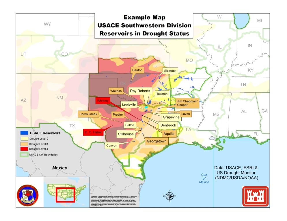
Within USACE Southwestern Division, there are 74 multi-purpose reservoirs designed to meet the needs of water supply users, navigation, hydropower, recreation, and fish and wildlife habitat. Since 2011, reservoirs within the Corps of Engineer’s Southwestern Region have been impacted by drought conditions. The map below illustrates USACE SWD reservoirs in which lake elevations have been reduced. Typical activities associated with each drought response designation are listed here: USACE Drought Response Actions.
The Corps of Engineers has continued its efforts within existing authorities to mitigate the drought’s effects in its management of water resources to ensure its projects continue to fulfill their multiple authorized purposes, to include navigation, water supply, recreation, fish and wildlife habitat, and environmental purposes. In addition, USACE has drought related authorities related to emergency water supply (Public Law 84-99) http://www.usace.army.mil/Missions/EmergencyOperations/Drought.aspx.